Text Products
Atlantic Tropical Weather Discussion
979
AXNT20 KNHC 291103
TWDAT

Tropical Weather Discussion
NWS National Hurricane Center Miami FL
1215 UTC Sat Aug 29 2026

Tropical Weather Discussion for North America, Central America
Gulf of America, Caribbean Sea, northern sections of South
America, and Atlantic Ocean to the African coast from the
Equator to 31N. The following information is based on satellite
imagery, weather observations, radar and meteorological analysis.

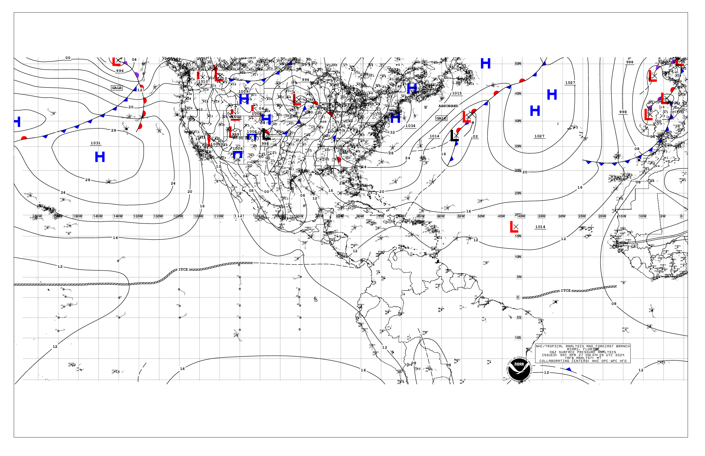
Based on 0600 UTC surface analysis and satellite imagery through
1055 UTC.

...SPECIAL FEATURES...

Atlantic Gale Warning: A strong tropical wave, remnants of Dolly,
is along 53W, south of 21N, moving westward at 20-25 kt. Numerous
showers and thunderstorms are occurring from 14N to 21N and
between 50W and 57W. Strong to gale-force winds are found in the
northern semicircle, along with rough to very rough seas, peaking
around 13 ft (4 m). This tropical wave will approach the waters
east of the Leeward Islands late today as a strong tropical wave,
with winds expected to diminish to 25-30 kt by then, below gale
conditions. Strong winds with gusts to gale-force, rough seas,
accompanied by squalls and thunderstorms will spread into the far
NE Caribbean, the Virgin Islands, and Puerto Rico and the adjacent
waters Sat evening into early next week in association with this
tropical wave.

Please read the latest HIGH SEAS FORECAST issued by the National
Hurricane Center at website
- https://www.nhc.noaa.gov/text/MIAHSFAT2.shtml

...TROPICAL WAVES...

A tropical wave is along 32W, south of 16N, moving westward at
around 15 kt. No significant convection is noted near this wave.

A tropical wave is over the eastern Caribbean, along 67W, south
of 17N, moving westward at 15-20 kt. Scattered moderate
convection is noted from 13N to 18N between 64W and 70W.

A tropical wave is over the western Caribbean, along 81W, south
of 21N, moving westward at 15-20 kt. Scattered showers and
isolated thunderstorms are evident in SW Caribbean.

...MONSOON TROUGH/ITCZ...

The monsoon trough enters the Atlantic through the coast of
Mauritania near 21N16W to 08N31W. The ITCZ extends from 05N35W to
10N52W, then resumes from 10N56W to 09N60W. Scattered moderate
convection is present near the monsoon trough in the eastern
Atlantic.

...GULF OF AMERICA...

A weak low pressure system in the northern Gulf waters and
divergence aloft are producing scattered showers and isolated
thunderstorms over much of the basin east of 90W. Moderate to
locally fresh easterly winds and seas of 2-4 ft are noted in the
Bay of Campeche, while weaker winds and slight seas prevail
elsewhere.

For the forecast, a weak area of low pressure over the northern Gulf
waters is producing scattered showers and isolated thunderstorms.
These storms may produce gusty winds and higher seas. This system
is expected to remain nearly stationary over the next several
days. The low pressure has a low chance of tropical development
over the next 48 hours and 7 days. Elsewhere, a weak pressure
gradient will support moderate or lighter winds and slight seas
over much of the basin through the middle of next week. Winds will
pulse to fresh with moderate seas off western Yucatan during the
evenings due to a diurnal surface trough moving west off the
peninsula each night.

...CARIBBEAN SEA...

A Gale Warning is in affect in association the remnants of Dolly.
Please, refer to the Special Features section for more details.

High pressure north of the area forces fresh to strong easterly
winds and rough seas across the south-central Caribbean. Moderate
to fresh easterly breezes and moderate seas are found in the
north-central and eastern Caribbean and also in the Windward
Passage. Elsewhere, moderate or weaker winds and slight to
moderate seas prevail.

For the forecast, a strong tropical wave, associated with the
remnants of Dolly, is producing a large area of showers and
thunderstorms a few hundred miles east of the Leeward Islands.
This system will also bring gale conditions and rough to very
rough seas to the area east of the Lesser Antilles today. Strong
winds, rough seas, and thunderstorms will spread into the far NE
Caribbean, Virgin Islands, and Puerto Rico tonight into early next
week. Otherwise, the pressure gradient between high pressure
north of the basin and lower pressure over South America will
support strong trades and rough seas over the south-central
Caribbean this weekend. These winds will diminish some early next
week as the aforementioned tropical wave disrupts the pressure
gradient, but will increase again by the middle of next week.

...ATLANTIC OCEAN...

A Gale Warning is in affect in association the remnants of Dolly.
Please, refer to the Special Features section for more details.

Scattered showers, with embedded thunderstorms, are found across
the waters between Bermuda and the Bahamas, particularly west of
65W. Converging middle level winds and a diffluent pattern aloft
are helping to induce this convective activity.

A ridge dominates the remainder of the Atlantic forecast waters,
anchored on a pair of surface highs north of our waters. The ridge
supports moderate to locally fresh easterly winds and moderate
seas across much of the forecast waters south of 26N and west of
35W. Farther east, fresh to strong NE winds and moderate to rough
seas prevail N of 18N and E of 24N to the coast of west Africa,
including the Canary Islands. Primarily moderate winds and
moderate seas prevail elsewhere to 35W, under the influence of the
ridge.

For the forecast west of 55W, a strong tropical wave, associated
with the remnants of Dolly, is producing a large area of showers
and thunderstorms a few hundred miles east of the Leeward Islands.
This system will also bring strong winds and rough to locally
very rough seas to the SE waters today. These conditions will
spread into the far NE Caribbean, Virgin Islands, and Puerto Rico
tonight into Mon and toward Hispaniola early next week. Elsewhere,
abundant moisture and an unstable atmosphere generate scattered
to numerous showers and isolated thunderstorms west of 65W.
Similar conditions are expected through early next week. At the
surface, the subtropical ridge will dominate the basin supporting
mainly moderate or weaker winds and moderate seas in the remainder
of the forecast waters. However, winds will pulse to locally
strong off northern Hispaniola through Sun night.

$$
Delgado